Weather
2026-05-14

General situation
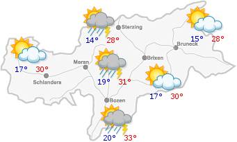
A low-pressure system centred over northern Europe will draw masses of cool, moist air towards the Alps.
The weather will become more unsettled, with showers moving in from the south-west. The snow line will drop, locally falling below 1500 m.
Low temperatures, with highs of between 10° and 16°.
Mountain weather

A low-pressure system centred over northern Europe will draw masses of cool, moist air towards the Alps.
2026-05-15

General situation
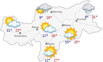
Moist and rather cold air masses will persist over the Alps.
There may be some local showers in the early hours of the morning. These will then ease off, but the sky will remain mainly cloudy. Widespread showers are expected in the afternoon.
Maximum temperatures will fall slightly further, ranging from 9°C to 13°C.
Mountain weather

Moist and rather cold air masses will persist over the Alps.
Forecast

The weather will also be unsettled at first on Saturday. As the day progresses, a northerly wind will blow in many valleys and the rain will gradually ease off.
On Sunday, the weather will improve, with clouds clearing and sunny spells.
On Monday, it is expected to be fairly sunny with some cumulus clouds. Temperatures will rise gradually.
On Tuesday, there will be a mix of sun and clouds.


